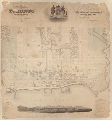
Topographical plan of the city and liberties of Toronto in the province of Canada. Surveyed, drawn and published by James Cane, Tophl. Engr.
Description
- Featured Link
- Creator
- Cane, James, Surveyor
- Item Types
- Lithographs
- Maps
- Description
- Dedicated by special permission to his Excellency The Right On. Sir Charles Bagot, G.C.B. Gov'r Gen'l of British North America by his very obedient, humble and devoted servant James Cane.
Includes Key to buildings and locality information. Photostat copy available. Sheet measured.|1842 Date Created year accurate; month and day unknown for 1842 - Notes
- 1 map: lithograph, colour; backed with paper.
- Date of Original
- 1842
- Dimensions
-
Width: 88 cm
Height: 94 cm
- Subject(s)
- Local identifier
- T 1842/5 Large (copy 1)
- Language of Item
- English
- Geographic Coverage
-
-
Ontario, Canada
Latitude: 43.6385221688501 Longitude: -79.3778478515625
-
- Creative Commons licence
 [more details]
- Copyright Statement
- Public domain: Copyright has expired according to the applicable Canadian or American laws. No restrictions on use.
- Contact

 View image at Toronto Public Library

